 |
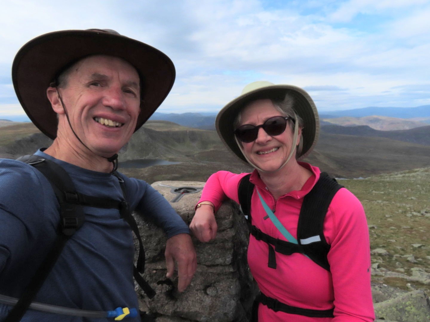
| On the summit of Lochnagar at 11:15am |
Wednesday we completely confused both Angus and Hector to go and climb Lochnagar. Not that hard a mountain, but 1hr45min drive away. We set the alarm for 05:30 so Angus would only be on his own for a couple of hours before Lisa collected him, with the same after she dropped him off. We had tried Lochnagar probably 15 years ago and got within 100m and 17m of ascent of the summit, but the weather was so bad that even that close to finishing we backed off. It has been niggling Brian ever since. Wednesday however was a perfect day weatherwise, though I was surprised that the temperature was only in single figures as we set off. We made it to the summit in better than book time which never used to happen with the Munro book, so that was very pleasing. As was being on the descent, before midday meeting everyone else on their way up. See our short Relive video with more photos: click here. Hopped into the car and back at the house before 4pm where Angus tried to tell us he’d been home alone all day! We know he was lying, Lisa had not dropped him off much more than half an hour before!
 |
| Setting off for Lochnagar in the early morning sunshine from Spittal of Glenmuick The first 3.8km were on forest roads like this, gradually getting steeper and rockier. Lochnagar is the pointed bit sticking up there in the centre. We started at 400m above sea level |
Thursday Angus was again with Lisa as she was having work done on her van on Friday, so I’d jumped at the opportunity of getting my shoe inserts moulded when they’d offered. This did mean we were up relatively early again, rather than having the lie in we both wanted, but it was a really good thing to get done. Back via Arbroath where we bought a pair of smokies for our dinner. Figured a week would be long enough for the smell to leave the house, though actually it’s not been too bad!
 |
| With a river crossing on the way, which Jackie navigated expertly |
Friday we took Angus out to Scurdie Ness lighthouse which was a lovely walk which we all enjoyed. See our short Relive video with more photos: click here. We even got back before the rain, which is more than can be said for Sunday. Brian and I went to the Arbroath market which was great, bought beer, game pie and cheesecake, must be all the food groups there! Got back to the car just as the heavens opened. It seemed clear when we took Angus out, but that didn’t last for the whole of his walk. Just as well he loves his towelling dressing gown! Particularly as he managed to get wet through again on his “you are doing dinner, so I might as well take Angus out” ‘extra’ walk. That’s both dressing gowns then!
 |
| The stone cairn marks the spot we leave the forest path and branch left on a trail down over moorland towards our mountain (distance: 3.8km, altitude: 678m, time: 1hr7min) |
Yesterday we did the same as Wednesday, up and out early for a slightly shorter drive (but still 1hr 30min) to the Glenshee ski area for another four Munro’s. Again we beat book time for the summits, but due to some dodgy navigation were slightly ‘misplaced’ on our way out. He enjoyed it more than I did, my knees were hurting before the last couple of kilometres which appeared to be vertically down, which is never good for the knees. See our short Relive video with more photos: click here.
 |
| We'd crossed open moorland and climbed the first slope for our first view of the Corrie of Lochnagar. (distance: 6.3km, altitude: 930m, time: 1hr45min) |
Today we are blogging while Brian starts on the tax returns. Sadly we have lost the blue sky and we have washing out, and Angus hasn’t had his walk yet, hmmm.
 |
| This was the steepest part of the climb, rising to a height of 1078m, 150m of ascent in 0.8km, time from start: 2hr10min |
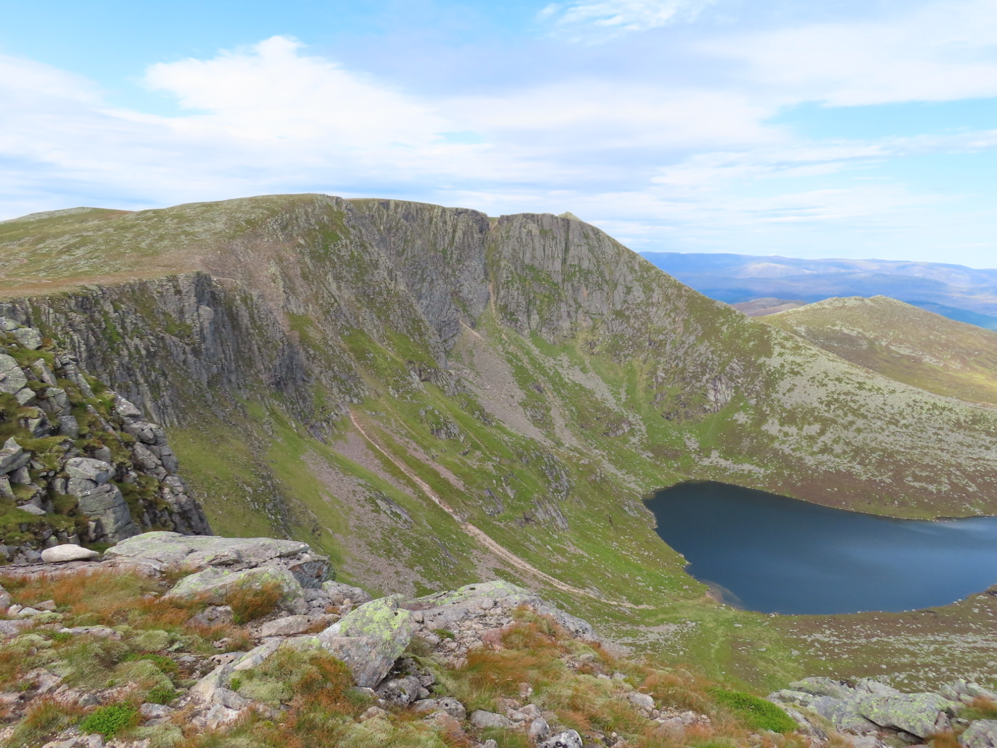 |
| But this was the view from up there. We were to follow the ridge off left and clockwise. There's just another slight rise then pretty flat to the pointy summit over there on the right hand side. What a view! |
 |
| Near the Cac Carn Mor cairn at 1140m looking past The Pinnacle down |
 |
| The final summit of Lochnagar |
 |
| On the summit. Distance: 8.99km, altitude: 1156m, time from start: 2hr44min (book time: 3hr2omin - didn't we do well!) and only 11:15am! Early lunch for us, we were hungry! 20minutes to enjoy the view and we were on our way down again |
 |
| And that's the way we have to go. Follow that path and then head off to the left following the ridge and then down |
 |
| Lots of Grouse in the heather with their distinctive call. Getting a photo is a different matter, but I finally got this one |
 |
| Back on the forest track heading back to the car. From here we'd got to go through the first set of trees in the centre and the car was in the trees just visible to the right. In all we walked 17.92km, our elevation gain was 865m and it took us 5hr23min. Just an hour and three quarter drive to get back to Angus and Hector! |
 |
| Next day it's Angus' turn on a coastal walk past Scurdie Ness Lighthouse |
 |
| A very pleasant walk at the point where the River Esk meets the North Sea. There have been several lighthouses here over the years as its a fairly dangerous inlet. You can see the 'new' lighthouse built by Robert Stephenson and an older disused one lower down. There's also a third behind us that was the first. There's a harbour behind us in the river that services ships for the oil rigs. The sign said that bottle nosed dolphins and grey seals frequent the area, we kept our eyes peeled, but they weren't playing today! |
 |
| Here we are parked up just north of Glenshee Ski Resort ready for our four Munro day. It was 8:15am and we'd been awake since 5:30. We were the only car in the car park (it was full by the time we returned). The mountain just left of centre is our first Munro, Carn An Tuirc, 1019m high. We start at 565m |
 |
| Now just a track, this bridge used to carry a military road, the main route through this valley |
 |
| The first 1.5km was a very pleasant walk alongside the Alt a' Gharbh-choire burn |
 |
| Looking back at where we've been as we start our ascent. The A93 road is across in the distance and the burn is snaking away below us. The eagle eyed will see another couple behind us on the track |
 |
| A frog enjoying the rather moist conditions underfoot. It was quite boggy - we got wet feet! |
 |
| The Munro book suggested a path round to the left, but the path we followed went straight up the face. It doesn't look that steep here, but it was! |
 |
| Finally on the fairly flat summit of Carn An Tuirc, or is it that pimple in the distance? We'll go and walk over there just in case! (In fact this was the summit - just. Distance from start: 3.23km, elevation: 1019m, time: 1hr22min (book time 1hr40min - so far so good) |
 |
| Not perfectly in focus, but I was pleased to get this photo of one of many Mountain Hares we saw |
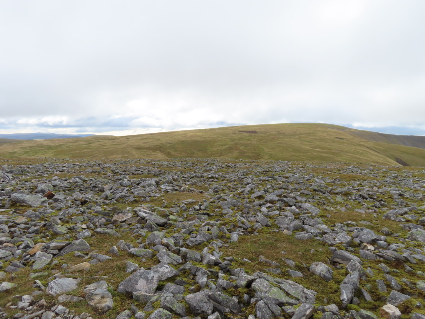 |
| From here the walk gets less than exciting. The whole plateau is relatively featureless terrain and, after all the rain we've had - very boggy. The highest point, slightly to the right in this photo is our second Munro, Cairn of Claise, 2.4km away. It was here that we first met another hiker, a 63 year old fit guy who lives in Letham and regularly walks these hills |
 |
| And here we are on the summit. Distance: 5.58km, elevation: 1064m, time: 2hr1min (book time: 2hr20min - still ahead!) |
 |
| Met our 63 year old on the summit too. Had chance to discuss our onward route. The two Munros are in view here, Tolmount is over to the left above the corrie you can just see. Our last one is the rounded hill to the right, Tom Buidhe. Plenty of boggy ground awaits us in between! Our man was going to do Tom Buidhe first and Tolmount last as he lives in that direction, so we headed off and parted ways (him making lots of ground ahead of us at his faster pace |
 |
| An example (there were many such areas) of the boggy ground we had to cross. You can see the track heading up towards Tolmount |
 |
| Approaching Tolmount summit cairn |
 |
| Summit photo on Tolmount. It was fairly cold as you can see. Distance: 8.73km, elevation: 958m time: 3hr (book time: 3hr10min) |
 |
| Final summit photo. Tom Buidhe, . We'd been down, through bog and up again, meeting the couple behind us on the top. They'd overtaken us as we'd stopped to talk at some length to our 63 years old as we passed each other. Distance: 10.71km, elevation: 957m time: 3hr39min (book time: 3hr40min - we'd slipped through stopping to talk!) |
 |
| Our route out. The summit ahead was our second Munro. Some descriptions leave that to the last, skirting round it on the way out. As we'd done it we skirted round it to the left, but it left us in uncretain ground, nearly dropping down into the wrong glen, having to back track uphill slightly. We would have been better to have gone back up to the summit and headed straight on down. But we didn't know that at the time |
 |
| By the time we'd regained the ridge we were behind the couple again, however we watched them go in the wrong direction ahead of us but they were too far ahead to contact them. We headed down the correct route towards that peak ahead and then down to the right into the Glenshee valley |
 |
| And there is the expanse of the valley that a photo never really captures. That's the A93 Glenshee road and you can just see the parking area with our car and many others now parked. Its a long way down! |
 |
| But we made it back for that lovely view before heading home. Total distance: 19.44km, total ascent: 913.7m, total time: 6 hours |
 |
| In between all this we've done a 1500 piece jigsaw of the world, sometime to the disgruntlement of Hector! |
 |
| Eaten Arbroath Smokies |
 |
| I've been on a total of three parkruns at West Links on the seafront at Arbroath |
 |
| Got very worried when finding Hector cat sitting precariously above a 20 feet drop on the balcony |
 |
| Taken Angus (he's that small black dot in the distance) on many walks around the old golf course at Letham Grange |
 |
| Drunk some very local beer brewed in a garage at Carnoustie |
 |
| And struggled to do the blog with Hector on my lap! We're having a lovely time here, what a pity its coming to an end on Saturday |
No comments:
Post a Comment