Don't forget to read Brian's version of the Via Verde cycle route at the end
El Rocio:
 |
| Daddy cat with three kittens in El Rocio |
A fourth night at the campsite in El Rocio gave us chance to have prawn salad, with the last of my bargain prawns, and to share the heads with various cats. Two kittens came by, and had a great time though they wouldn’t listen when I said the last two were for daddycat. He had to make do with some legs when he finally turned up! He seemed to forgive them though, as I walked past their sleeping spot the following morning he was curled up with three of the kittens...
Matalascanas beach:
 |
| On the beach at Matalascanas |
 |
| Our parking near to the beach |
Off to the beach then, I don’t know why he was so keen on going to the beach at Matalascanas, but he was, a bit of a wild camp in a carpark, but it was very close to the beach and very relaxed. (parking location: 36°59'01.8"N 6°31'44.2"W) (parking facilities with photos: click here then on item 68 in list) We went for a nice walk, had lunch, followed the boardwalk through the dunes, and took chairs and beer and crisps, down to the beach to watch sunset.
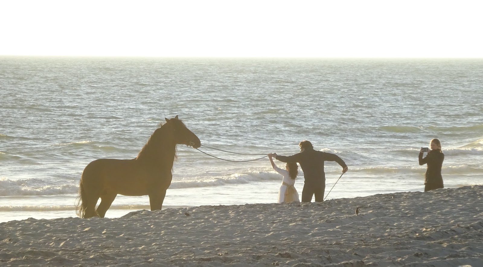
 |
| That horse on the beach |
 |
| Here we are waiting for the sunset |
Our English neighbours had recommended this, they had also said it got cold at night, but we didn’t realise it got that cold, that early! It wasn’t that good a sunset sadly but we were intrigued by the bride and groom at one end of the beach and the family with horse the other! By then it was a matter of pride, and it did make us laugh, and at least we didn’t get stuck in the dark, on the rocks as we did in New Zealand when we had a romantic sunset meal there! Here's the link to that NZ 'romantic' entry: https://brianandjackiecross.blogspot.com/2013/05/sunrise-sunset.html
 |
| The sunset |
La Rabida and Christopher Columbus' ship replicas:
 |
| Replicas of Columbus' three ships that sailed off the map to find the New World of the Americas in 1492. Centre in the flagship, Santa Maria, right is the Pinta that became the flagship on the return after the Santa Maria ran aground in La Espanola (modern Santo Domingo) and was used to build Fort Christmas and found the first colony there. Left is the tiny Nina |
 |
| In the hold of the Santa Maria |
We only stayed for one night, we’re really not beach babes. I had tried lying on the beach, but it was actually a bit windy and cold. The overnight was lovely, but with another wild camp to follow we didn’t want to risk filling our facilities.....! We moved on to La Rabida, on the edge of Huelva. There was a huge amphitheater and empty carpark, so we were surprised to arrive and be the only ones there. (Not even our Scottish friends, did they stay or had they already moved on?) (Parking location: 37°12'38.6"N 6°55'30.4"W) (parking facilities with photos: click here then on item 69 in list)
 |
| Columbus' first journey |
 |
| The Santa Maria |
The Museo de las carabelas was fantastic though. Three full size replicas of the ships Christopher Columbus (Cristobal Colon) took to discover the New World. They are so small, to have set off into the unknown with crews of 20, 30, and 40 and all their supplies on the various ships, really was very brave. The museum was very interesting, well worth the €1.50 seniors rate he charged us! If anyone is going to ask me if I’m a senior I’m afraid I’m going to take the discount!
 |
| Columbus' second, third and fourth journeys. On his fourth journey he actually set foot on mainland America, firstly in Honduras, becoming the first European ever to set foot on that continent |
 |
| The monastery (who arranged the finance) and where they prayed before setting out |
The surrounding area with the monastery where Columbus prayed before and after the voyage, the monument, and the botanical gardens, all made for a splendid day out. Seven mobilehomes ended up parking for the night, including a German lady and her small dog, driving a bigger Frankia than Ted (her, not the dog). We see so few, it’s still commentworthy....
 |
| The discovery monument in Rabida |
Gibraleon and the Via Verde cycle route to nowhere:
 |
| Statue of Columbus in Rabida |
There was no reason to stay though we could have quite easily, but toilet emptying facilities called so we headed north another 40 minutes to Gibraleón a small town at the start of a ‘via verde’ or green way, one of many cycle paths on old railways. (Aire location: 37°22'18.8"N 6°57'45.1"W) (Aire facilities with photos: click here then on item 70 in list) This was our first, and may have been a mistake. It was marked as ‘broken’ on the website, and it was.... we ended up bumbling about on dirt tracks, roads and undergrowth before giving up the unequal struggle.
 |
| Our motorhome parking in Rabida |
Not before we’d gone under a tunnel, that was a bit muddy. My side was a bit muddy, but I only got one foot built up like a platform. Brian’s side was a bit muddy and he ended up three inches taller, unable to lift the weight of his feet or turn the wheels of his bike with the mud build up..... fortunately it was him and not me, the other way round and he may not have returned.... oh well, his bike needed a good scrub with a tooth brush! Brian's version below!
 |
| The secure (and free) motorhome Aire in Gibraleon |
 |
| The iron bridge on our Via Verde cycle |
We stayed two nights, band practice the first night was ok, once they stopped tuning up and actually started practicing, while last night was very sociable. Alex in his yellow self conversion next to us and Jeremy and Debs in theirs next to him. He is a climber/skier/cycling kitesurfer who did some backpacking about 10 years ago.
Once we started talking he took us out of the pigeon hole he’d neatly slotted us into and we had a great time. He even had a spare cigar lighter plug which he was willing to donate to Brian’s laptop. The charger for which gets very hot, so hot it had melted the plastic and whatever held the end bit out. It really has been dodgy for a while, but is the only means of charging the laptop if we have no electricity, which is most of the time, so do you risk ‘fixing’ it beyond repair? They ignored me and did, hopefully it’s all ok. It seems to be so far!
 |
| The really nice first part of the cycle way |
Alex was interested in Brian’s roll up piano, as he can actually play. Not sure Jeremy and Debs were that impressed as they were having a post lunch siesta, but much chatting and drinking ensued and we had a lovely evening till chased inside by mosquitoes. Scary they were...
Isla Cristina:
Another 40 minutes has brought us to an independent Aire €10 free WiFi, toilets, showers and a lovely view over the marshes. (Campsite location: 37°13'18.3"N 7°19'19.8"W) (Campsite facilities with photos: click here then on item 71 in list) Tomorrow we will find a bit more of the via verde, for a little more cycling, a nice lunch and hopefully a boat trip. What’s not to like?
Brians version of the Via Verde de Litoral cycle route.
We've met quite a few people who have recommended the Via Verde cycle routes and how pleasant they are. The official website (http://www.viasverdes.com/en/principal.asp) states there are 2,700km of them all over Spain and are closed sections of old railway lines that have been converted into cycle ways (like a lot in the UK have). Old railway lines are generally flat or on a slight incline/decline, so are very easy, often they are elevated to give splendid views, fresh air and sunshine. The website goes into detail saying "It is well worth taking a trip on one of these trails where motor vehicles are forbidden. Not even mopeds are allowed on these routes, which are synonymous with safety and respect for the environment. From north to south and east to west, there are 117 itineraries and thousands of kilometres to be covered on fascinating routes that will take you to stunning spots and reveal a great deal about Spain's cultural heritage. The panels and signposts along the way will keep you constantly informed about interesting artistic locations and landscapes. In some cases there are even guides and guidedpublic paths visits available for certain areas: you just have to choose your line."
 |
| First major problem encountered. Lots of undergrowth and an eroded path making it impassable. Detour required! |
All this sounds really good and it goes on to say " On your way you will also find accommodation, guesthouses and restaurants where you can rest and replenish your energy. It’s worth to mention that 98 old railway stations have been restored as rural hotels, restaurants, cafés, rent a bike point, office information or small museums... "
OK, I'm sold, where is the nearest one? Well, the biggest problem we face is finding somewhere safe to leave Big Ted and, of course we will have to do it twice, once out and again in reverse to get back to BT. Not wanting to go out of our way too much I looked in SW Spain, where we were headed. Ah, there's on that starts in Gibraleon and heads west to the Portguese border, 33km away. Gibraleon has a free Aire that is secure in its own compound with lots of other motorhomes. So we could do as much as we want then turn round and come back again, stopping at one of those restored railway station come cafes they encoragingly talked about on their website I thought. Sounds fabulous and I'm already getting excited.
The first problem on this one, the Via Verde de Litoral (http://www.viasverdes.com/itinerarios/itinerario.asp?id=63) is the warning notice it postes. It says: "Attention: Via Verde with serious maintenance problems. There are discontinuities in the layout, transit of numerous motor vehicles, and bridge with platform breakage, which makes it very dangerous to pass through."
 |
| The wortst section, very thin and in a cutting. Below is the very soggy underpass we negotiated |
Hmmm, but how bad can it be? We've got mountain bikes that can cope with some rough ground and we're rufty-tufty people who like a bit of adventure. This could be just what we're looking for!
Gibraleon is a lovely little town, nothing to go out of your way to see, but is very clean, interesting and has lots of bars and cafes. The Aire is in a quiet area of town in a new car park with separate secure area specifically for motorhomes. There were quite a few parked there when we arrived including some Brits who we got on well with. We walked into town had a beer and tapas, relaxed in the sunshine, found the start of the Via Verde route, which was a wide, very flat path that looked perfect. This is going to be good, the weathers warm and sunny and set to remain that way, so we'll set off earlyish tomorrow before it gets too hot, take some lunch and have a great time, so we thought!
Next morning, out with the bikes, on with the shorts and t shirts, sun cream and some lunch in a basket on front of the bike and off we went in the slightly chilly morning, but knowing it was due to get to high 20's by the afternoon.
The first problem we encountered within 100m of starting was a school outing that were using it as an athletic track, so we stopped, wove our way in between to get past them then on we went again. Ahh, the fresh air, the open countryside, the views... There's a big iron bridge over a wide river that had metal sheets making it quite safe, so we rode over it and on along an arrow straight path with fabulous views. What a great decision this was!
We came to a section crossed by a rough track that had a tractor going over it to gain access to his olive groves and we went over it to find the track suddenly thick with vegetation and a single, narrow way between nasty looking undergrowth and overhanging trees. We stopped, I walked on to find the path eroded away by a stream, making it impassable. Just then we saw other cyclists bypassing that bit and going uphill on another track, but away from the Via Verde. A quick look at Navmii, the app on my phone that has local maps and shows public paths showed it as a route that went in a different direction. But hang on, I could see another faint path that swung around and rejoined the Via Verde. We're going that way. "Are you sure?" Jackie said, "Of course, follow me!" Off we went. Ooops, slightly wrong there, back up, try this bit, round there, through those trees, down that bank....Ahh, here we are, the old track again.
Well, its a bit bumpy now, but not too bad and it's definitely the old railway track as here's an embankment and an old bridge with no guard rails (that's a bit dangerous isn't it?), but it's great, isn't it! Oh, it's got a bit narrow again, lots of undergrowth, very narrow and now in a deep cutting. A scan at Navmii showed it went under a motorway, disappeared for a bit and then reappeared and continued on. "Come on" I say, "it'll be fine" We blunder on through undergrowth aware there's no escape up the steep bank. Here's the tunnel coming up that goes under the motorway slip road. I was ahead and got there first to see it waterlogged and obviously been traversed by many goats or cows so it was probably slurry. There's a couple of narrow edges of mud and deep water the length of the tunnel of some 20m. So, do we go back or do we try and get through this? Its an adventure right? Lets go on. To my surprise Jackie agreed so, deciding the left side looked not too bad, I trod carefully as close to the left as possible and pushed my bike through some mud and water. It's not going well, the wheels have stopped turning, why is that, oh it'll be the huge quantities of gloopy mud that have built up round the wheels and frame. My feet feel heavy, why is that, oh it's the huge quantities of mud stuck to my shoes making them look like tennis rackets on my feet.
Jackie sensibly chose the right hand route and got very little mud on her. By the time we got to the other side I just couldn't belive how much mud was on my shoes and the bike. Is there seriously any mud left in the tunnel? Surely most of it is on my bike! I poked a bit off to make the wheels turn and scraped my feet, but it removed only a limited quantity. What do we do now, the path is thick undergrowth and now even worse, but at least we're out of the cutting. A slight detour onto a farmers fields and back on the track when possible and then to the tunnel under the main motorway. Mercifully it was dry with a concrete base so we made our way through it and out the other side. Tim Holden, if you are reading this, it definitely reminded me of the mountain bike route we did on John F's stag weekend years ago when you rode through a huge puddle at high speed just as I was carefully going through, absolutely drowning me in muddy water, and you with an evil laughing sideways look at me as you went past!
 |
| My bike after wheeling it through the mud. No photos of my shoes and, stupidly I didn't take a photo of the flooded tunnel |
With patience a little short we decided to end it there, some 10km of the 33km. but how to get back without having to go back through that lot again. A passing tractor, who's driver gave us some funny looks provided the answer, along a track, up onto the motorway exit roundabout and away. That's our way, so off we went over the motorway, along the slip rod to see the dastardly track below, along the main road a bit and then ducked back down onto the track having bypassed the horrible bit.
A quick break for our sandwiches on the bridge with no barrier (don't lean back!) and then back along a steadily improving track back to Big Ted. Another hour or so to fully wash my bike and shoes, that dried very quickly in the hot afternoon sun, a glass or two of wine and a laugh with our new found Brit friends.
 |
| Nearly back to Gibraleon and back on the good track |
So, did we find the "accommodation, guesthouses and restaurants where you can rest and replenish your energy. It’s worth to mention that 98 old railway stations have been restored as rural hotels, restaurants, cafés, rent a bike point, office information or small museums... ". NO! But it was an experience. Don't believe all you read!
 |
| Traversing that big iron bridge again with Gibraleon in sight |
 |
| Our campsite near Isla Cristina with views over the marshes |


No comments:
Post a Comment